SkySkopes has the geospatial expertise, cutting edge technology, and multi-platform know-how to optimize your asset management systems. With our expert team as your geospatial partners, you can mitigate risks, improve efficiency, and substantially increase the value of your enterprise.
As your challenges evolve, we can support you with data analytics and spatial insights to create a vision that will keep you ahead of the curve and maximize your ability to achieve your business objectives. With our precise, remotely sensed data, SkySkopes can build robust solutions that integrate with most, if not all, of your in-house platforms.
You can feel confident that our dedicated team will design methodology to accelerate your performance and overcome obstacles to your growth.
Remote sensing SERVICES
LiDAR Processing
Calibration
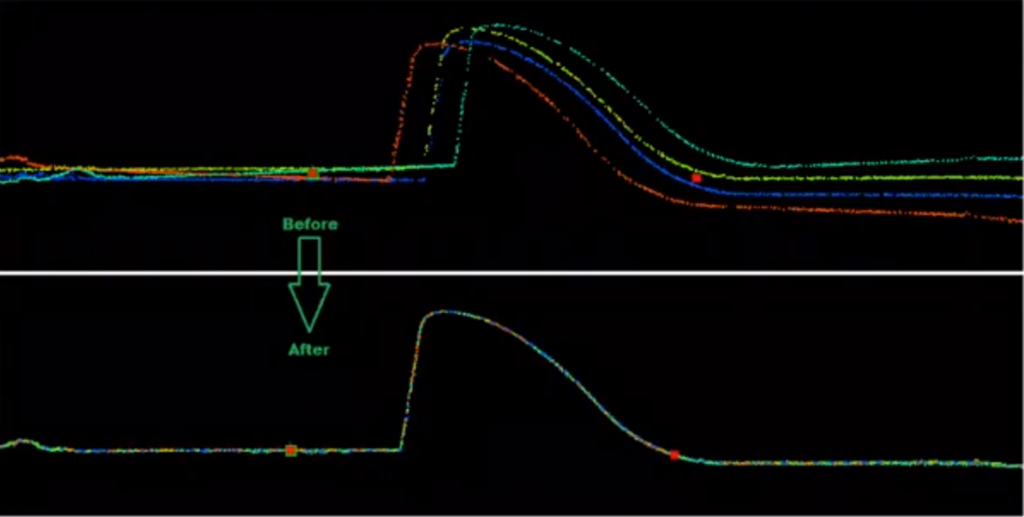
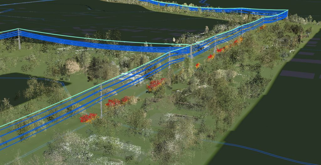
The first step in LiDAR processing is to calibrate the points between overlapping flight lines. Using tie points, we are able to calibrate points to centimeter level accuracy.
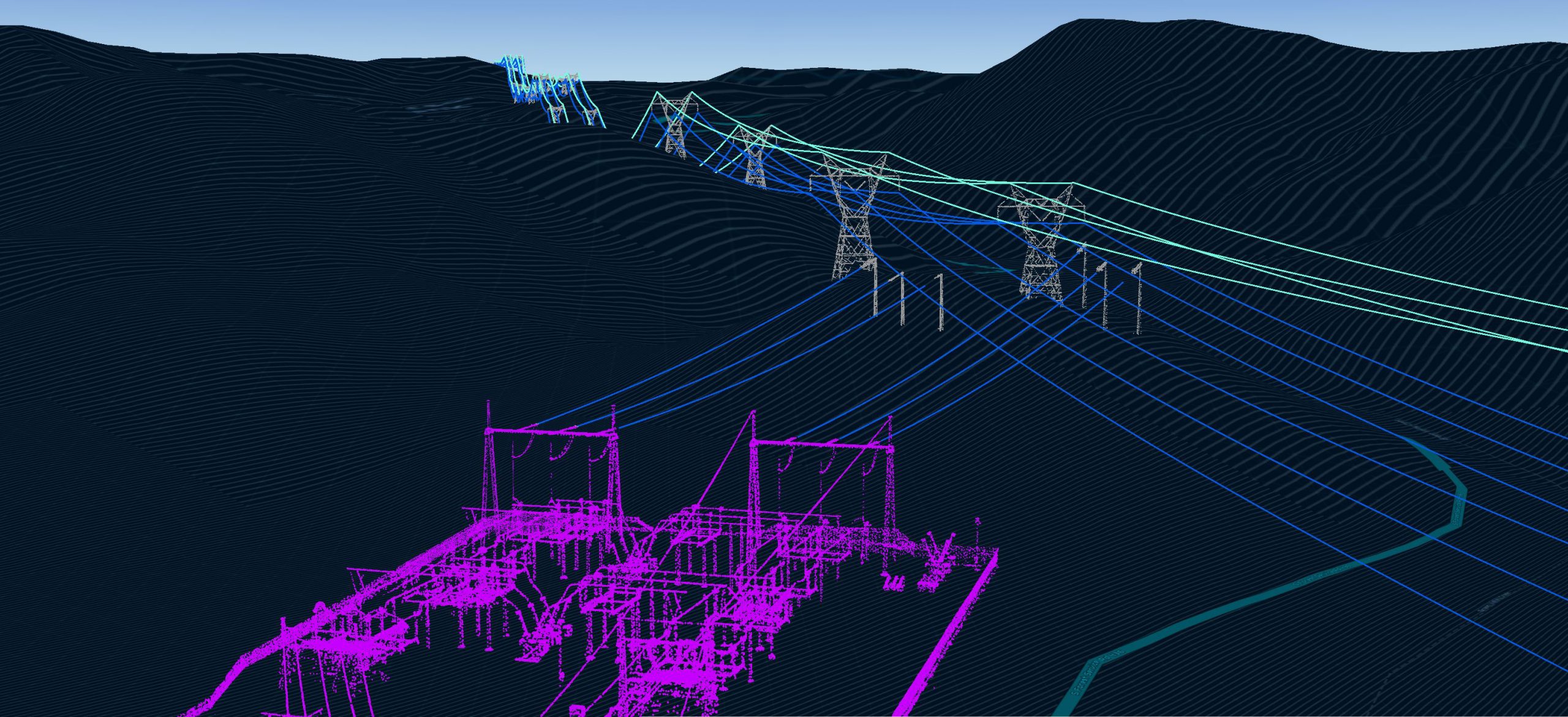
Classifications
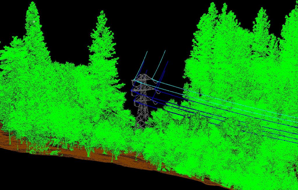
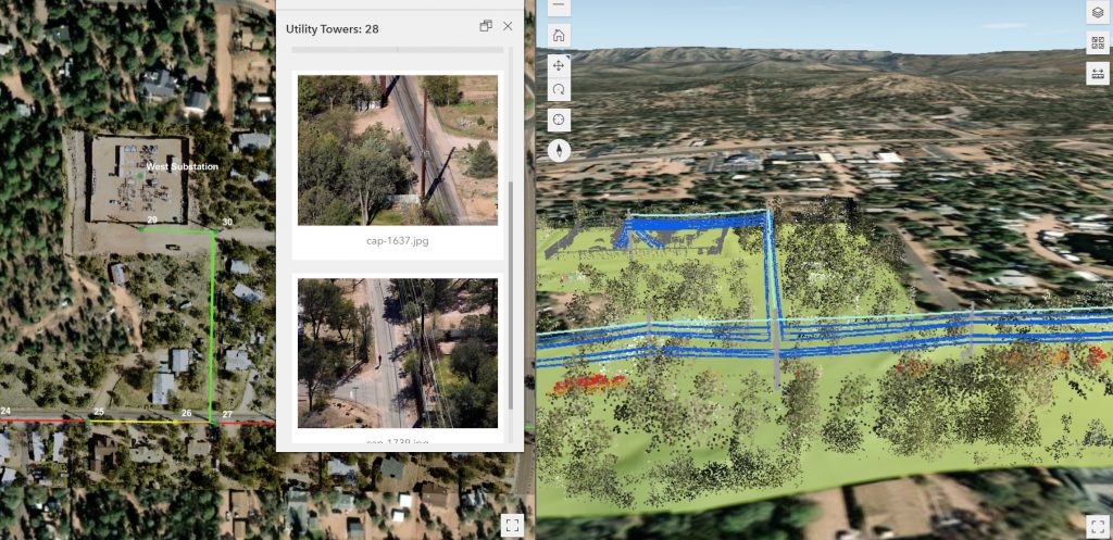
The separation of point clouds into different classes is an important step in processing LiDAR. Separating the ground, vegetation, buildings, and other objects is crucial for creating high quality data products.
Feature Extraction
Using the high density point clouds, we can create vectors of roadways, powerlines, railways, etc. These files can then be used for design and analysis.
Image Processing
Still Imagery
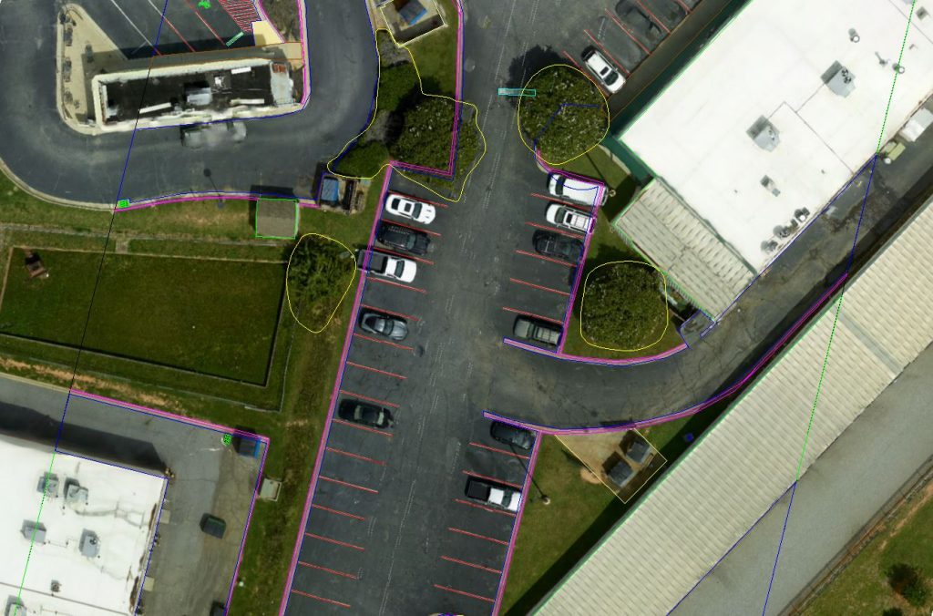
High resolution images are geotagged and go through our quality control process to make sure they meet our high standards.
RGB Orthophotography
Using standard RGB (red, green, blue) imagery we are able to create survey grade orthomosaics that can be to any specified ground sampling distance and scaled up to even the largest project areas.
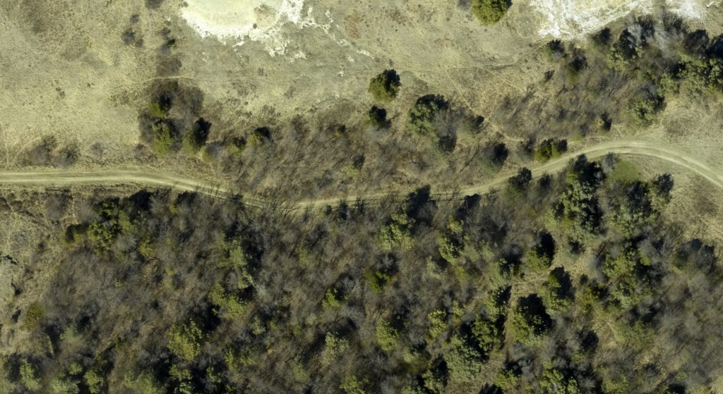
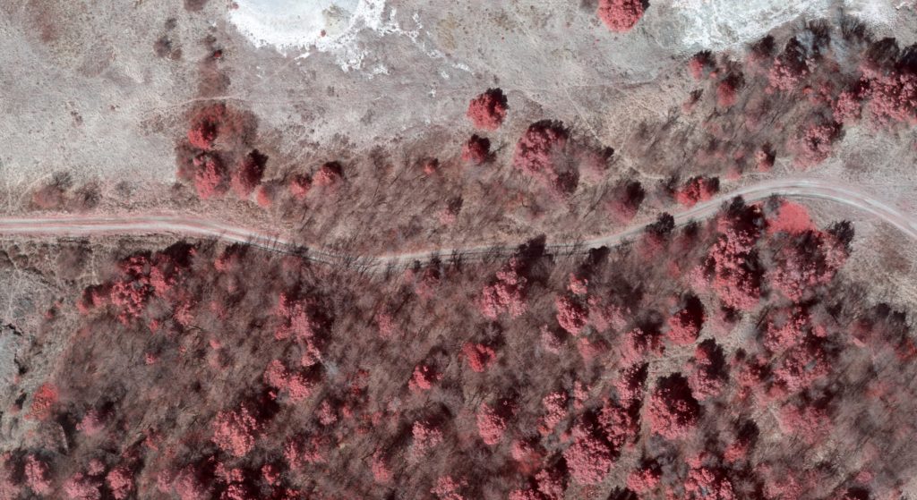
Multi-Spectral Orthophotography
Using sensors capable of collecting more than 4 bands of light we are able to process NDVI maps to provide vegetation health and coverage.